Why there are several “courses”
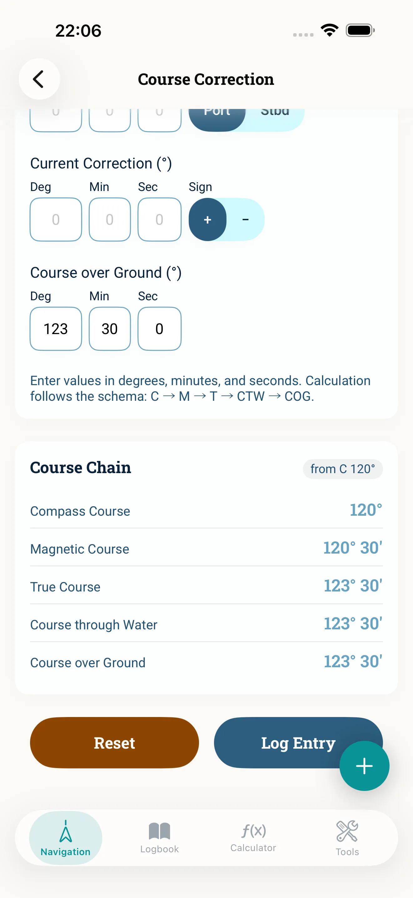
On the chart you plan in true (geographic north). At the wheel you read the compass — magnetic north, plus your boat’s deviation. Corrections sit in between. The course chain orders those steps so you get from the planned chart course to the compass course (or the other way around).
rwK — true course
rwK is the course relative to true (geographic) north without the effect of wind and current. With no wind or current it equals the line you plot on the chart; with leeway and tidal stream your track over the ground differs from it (see below).
Example: you want to go from waypoint A to B — rwK is the direction of the line on the chart (variation not applied yet).
mwK — variation-corrected course
From rwK to magnetic direction you apply variation:
mwK = rwK ± variation
A common mnemonic: East least, West best — for easterly variation subtract, for westerly add (always verify the sign on your chart or model).
We cover variation in What is magnetic variation?. The calculator is under Variation.
MgK — compass course
MgK is the course shown on your steering compass:
MgK = mwK ± deviation
Deviation is boat-specific. Without compensation it can change a lot with heading — hence the deviation table.
Wind and current: from rwK to COG
Wind and current push your boat off its heading. These corrections are applied after the true course (rwK), not after the compass course:
- rwK + leeway = course through the water (KdW)
- course through the water + tidal stream = course over ground (COG, KüG)
COG is what you see on the chart again. Course conversion in NauticCalc ties variation, deviation, wind and current together in one workflow — including the current triangle when set and drift are known.
From compass to chart
You know the compass course you are steering and want the resulting course over ground:
- Read MgK
- Apply deviation and variation → rwK
- Apply leeway and tidal stream → course through the water and COG
Errors add up both ways. A consistent app helps keep signs straight.
Example (simplified)
| Step | Value | Note |
|---|---|---|
| rwK | 095° | course without wind and current |
| Variation | 3° E | East least → mwK = 092° |
| Deviation | 2° W | West best → MgK = 094° |
Wind and current are deliberately left out here — they belong between rwK and COG. Two fully worked exercises with leeway, forwards and backwards, are in Course conversion step by step.
Offline on the bridge
The course chain and allowances are core calculators in NauticCalc. They run without internet — important offshore or in coastal dead zones. What else works offline (tides, logbook, GPS) and what needs a network or your own API keys is in Sailing without internet and Offline navigation.
Typical exam and practical traps
- Variation and deviation swapped
- Current treated as a “course” instead of an allowance
- rwK and COG confused when planning ETA
- Old table values instead of current WMM
Bottom line
rwK, mwK, and MgK are not random abbreviations — they are the links from chart to steering compass. Master the chain and you can add wind and current deliberately — and run the math quickly and traceably with NauticCalc at sea.
Read next: Course correction step by step · Current correction · Variation · Download the app
