Course, current, variation —
calculated on the bridge, without signal.
The digital toolbox for skippers — traditional navigation meets modern iOS technology.

Features
Every tool you need at sea.
31 professional instruments organised by task.


Current / set & drift
Course and distance allowing for tidal stream or current.
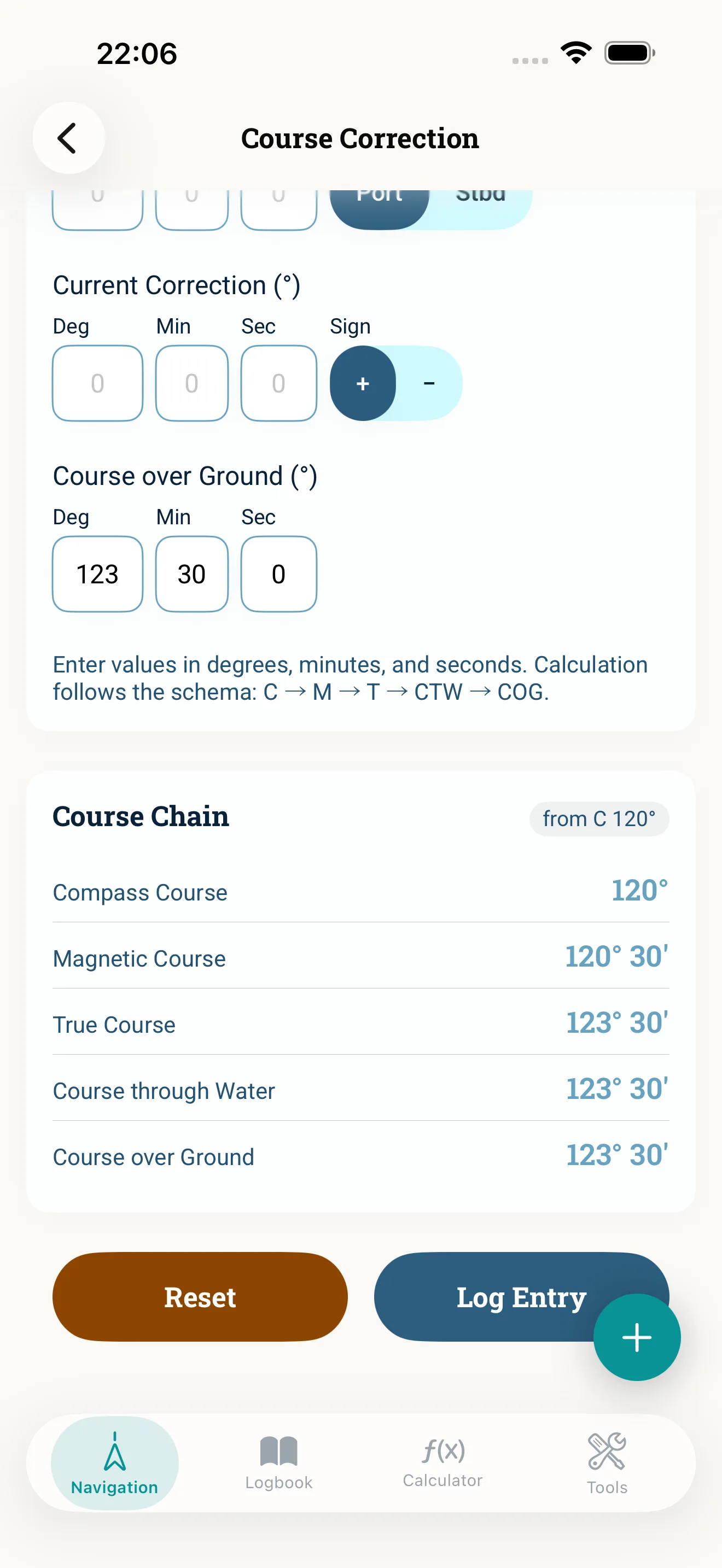
Learn more →Compass correction
True ↔ magnetic ↔ compass course with variation and deviation.
Learn more →Wind allowance
Leeway allowance from wind strength (Beaufort or knots) and point of sail — result in degrees.
Learn more →Magnetic variation (WMM)
Magnetic variation from the World Magnetic Model 2025.
Learn more →Course conversion
Switch quickly between true, magnetic and compass courses.
Learn more →Deviation table
Create and save a deviation table for your vessel.
Learn more →Apparent Wind
Work out apparent wind from true wind, boat speed and course — and back again.
Learn more →Onboard instruments (beta)
Live values from the boat network over NMEA 0183, Signal K and NMEA 2000 — speed through water, course, wind and depth. Needs a gateway on the onboard Wi-Fi.
Learn more →GPS position
Live coordinates with accuracy read-out.
Learn more →The logbook that keeps track for you.
The app logs position, course and speed at a set interval and suggests course changes as events — with GPS position, time and a confidence score; you confirm each one. Forty-seven event types cover everything from reefing to MAYDAY. Weather data attaches to each entry; crew and watches attach to the passage. Watch handovers are logged with course and position.
Export as a PDF passage report (with chart and crew list), CSV or JSON — crew data can be masked on request. Manage and archive multiple vessels and passages with statistics.
See it in action.
Built for the bridge — by day, by night, in the spray.


By skippers, for skippers.
Built by a skipper, in Switzerland.
“NauticCalc came from wanting a tool that actually works on the bridge: offline, precise, no cloud lock-in. It started with compass correction and has grown over years and many sea miles.”
“The app is tested by skippers from German-speaking sailing communities in a closed TestFlight beta. Every feature comes from on-board experience — anything that doesn't help gets cut.”
“Nautical accuracy before marketing: WMM2025 magnetic model, harmonic tides from NOAA NOS constants (XTide dataset), documented calculations. Open-source libraries, properly attributed.”
From the App Store
All reviews on the App Store“Lange hab ich eine App gesucht, die den scheinbaren Wind berechnet. Hier ist sie endlich. … Super Werkzeuge auch offline nutzbar. Top das Logbuch.”One purchase. Every calculation runs locally.
No subscription, no login, no reliance on our servers. Available on the App Store.


CHF 9.- one-time
Price may differ in the App Store.
You choose which data you load.
Weather and worldwide live tides use Stormglass, OpenWeather and WorldTides; the plain-language briefing uses Claude. You open an account directly with the provider — for weather and tides the free tier is usually enough — and enter your API key once in NauticCalc. The key stays in Apple’s Keychain on your device; we never see it.
Marine weather with wind, waves, visibility and pressure — hourly up to 10 days.
All-round weather worldwide, including One Call API and forecast.
Primary source for European and global tides — Mediterranean, North Sea, Atlantic, Pacific. Accurate predictions for ports worldwide.
Puts the voyage briefing into plain language — built from the calculated values, with no forecasts of its own. Without a key you still get a compact offline summary.
NauticCalc does not sell its own subscriptions. API keys are stored exclusively in Apple’s Keychain and are never sent to us. Without keys, all calculators and the logbook work fully offline; only live weather, online tides and the AI explanation need a key — the latter falls back to a compact offline summary.
What's changed since launch.
Questions, answered.
Yes — all calculations, the logbook and GPS tracking run locally on your device. Live weather and worldwide online tides need a connection; offline tides use embedded harmonic constants (XTide harmonics-dwf-free / NOAA National Ocean Service) and work without a network — coverage focused on US waters.
NauticCalc includes about 1,000 stations from the harmonics-dwf-free dataset (XTide ecosystem; harmonics based on NOAA National Ocean Service, public domain). The focus is the United States (including associated areas), the Pacific and selected international ports — computed entirely on device, without a tides server from us. For the Mediterranean, North Sea, Atlantic and other European waters, NauticCalc fetches live data via your WorldTides API key. The free plan (100 calls/day) is enough for typical skipper use.
Only on your device. We operate no server, no account, no cloud sync. Your data belongs to you; export it any time as CSV, JSON or PDF.
iOS 17.6 and newer. The app uses modern Swift APIs including current CoreLocation and MapKit features.
No — the app itself has no subscriptions. For live data from Stormglass, OpenWeather or WorldTides you create an account directly with the provider (the free tier is usually enough) and enter your API key once in NauticCalc. Without keys, all calculators and the logbook still work.
NauticCalc uses recognised nautical formulas and the NOAA WMM2025 magnetic model. The app is an aid for skippers and not a substitute for certified navigation equipment.
Ready for the next course?
NauticCalc on the App Store. CHF 9.- one-time, no subscription, no cloud.
CHF 9.- one-time · No subscription