What the sextant measures — and what it doesn't
With a sextant you measure the angle between the horizon and a celestial body. That reading is the sextant altitude (Hs). It is not the angle you calculate with.
Your eye is not at sea level, the visible horizon is not truly horizontal, the atmosphere bends the light, and the sun is not a point source. Four deviations, then, before the reading is usable. Only after correcting them do you have the observed altitude (Ho) — the angle an observer at the centre of the earth would have seen without an atmosphere.
On an ordinary summer day, Hs and Ho are easily 20 arcminutes apart. That is 20 nautical miles of error in your position line.
The four corrections
Index error (IC). No sextant is perfectly adjusted. You establish the offset against the horizon or a star and enter it with its sign. It belongs to you and your instrument, not to the almanac.
Dip. From 2 metres of height of eye you do not see the horizon level but slightly below — about 2.5 arcminutes on a yacht. It is always subtracted and depends only on your height of eye.
Refraction. The atmosphere appears to lift a body. At the horizon the effect exceeds 30 arcminutes; at the zenith it is zero. This is why low altitudes below roughly 15° are unreliable: there, refraction varies strongly with temperature and pressure.
Semi-diameter and parallax. The sun is a disc about 32 arcminutes across. You do not measure its centre but a limb — and add or subtract half the diameter. For the sun there is also a small parallax of under 0.2 arcminutes.
Lower or upper limb
By day you normally bring the lower limb down to the horizon: the disc then sits cleanly on the horizon line and the contact is easy to judge. The semi-diameter is added.
The upper limb is the fallback — for a low sun in haze, when the lower limb blurs into the horizon. Then the semi-diameter is subtracted.
The difference between the two is a full solar diameter, roughly 32 arcminutes. Enter the wrong limb and your position line shifts by 32 nautical miles. It is the most common mistake in the whole calculation — and the most expensive.
What the calculator in NauticCalc does
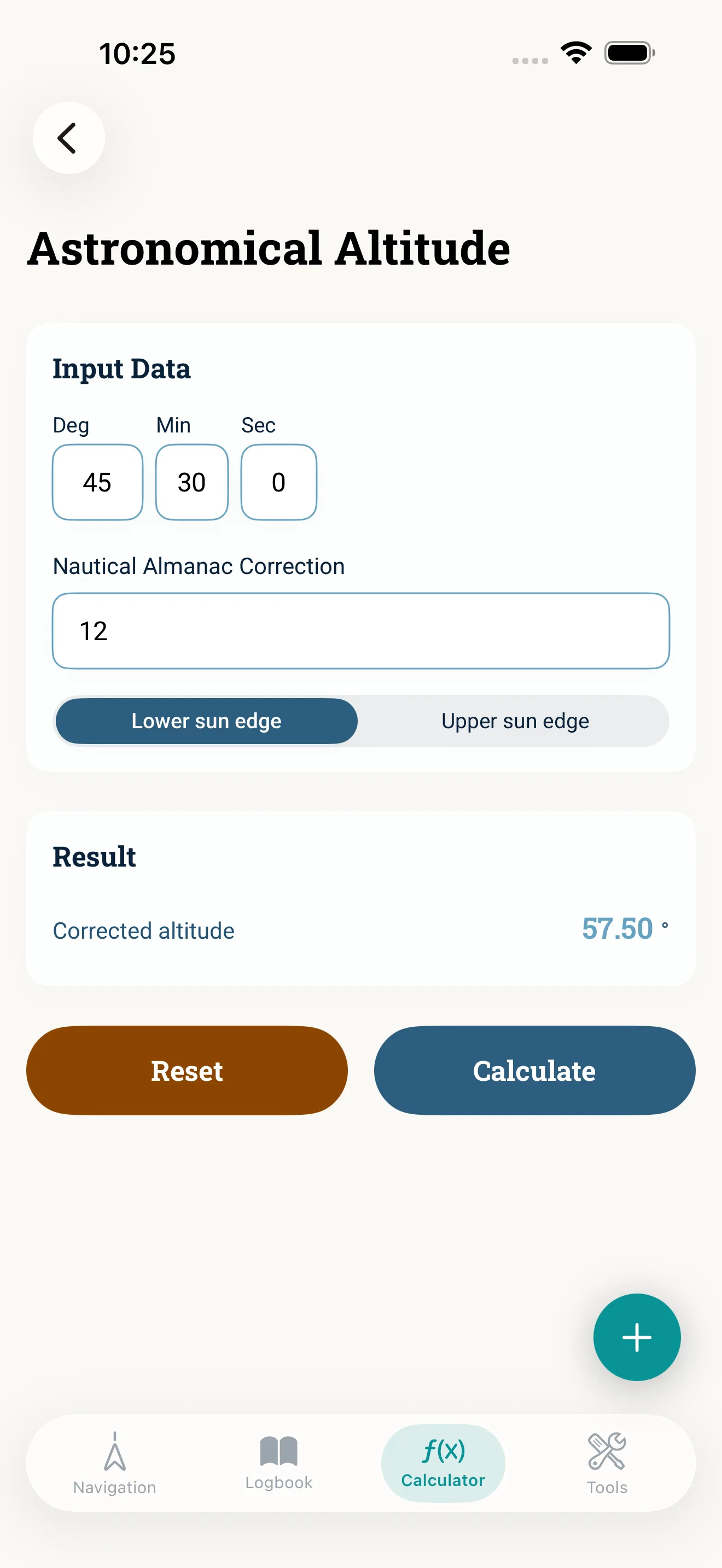
The astronomical altitude tool takes your reading in degrees, minutes and seconds, the correction from the Nautical Almanac, and which limb you brought down. Out comes the corrected altitude.
That settles the arithmetic — the part where signs get flipped at the chart table in a seaway. The correction values themselves still come from your almanac: it knows the date, the time and the body; the app does not.
And then? The corrected angle becomes a position line — via computed altitude, azimuth and tables or a formula. NauticCalc does not do that. If you want full sight reduction, you need tables, dedicated celestial software, or paper and patience.
Noon latitude, the one exception
One case needs none of that. When the sun bears due south — the culmination, local apparent noon — it is simply:
Latitude = 90° − corrected altitude + declination
Nothing more. You take readings over a few minutes until the altitude stops rising, keep the highest, correct it, look up the declination in the almanac — and you have your latitude. No clock, no tables, no azimuth.
That is exactly what this calculator is for. Noon latitude is the one piece of celestial navigation you can practise on board in five minutes.
Common mistakes
- Wrong limb selected — 32 arcminutes out, the most conspicuous shift there is.
- Dip added instead of subtracted — it always comes off.
- Height of eye guessed rather than measured — one metre is worth nearly an arcminute.
- Altitudes below 15° used — refraction is barely dependable down there.
- Index error forgotten — it stays constant until the sextant takes a knock. Which is precisely why it gets overlooked.
Why it stays on board
A sextant needs no power, no network and no satellite signal. It is the last fallback when everything else has gone quiet — and the method behind it is over two hundred years old and does not change.
None of this argues against GPS. But once you have done it by hand, you understand better what your plotter is actually doing. And on a quiet afternoon at sea, a noon latitude you worked out yourself is simply a pleasure.
Read next: All tools · Light on the horizon · Offline navigation