Prerequisites
- NauticCalc on the iPhone (iOS 17.6+)
- Start, possible stopovers and destination
- Optional: a weather API key for live data and an Anthropic key for the plain-language summary (both BYOK)
Step 1: Draw the route
Open Voyage Briefing and draw the route right on the map — start, stopovers and destination.
Step 2: Check the legs
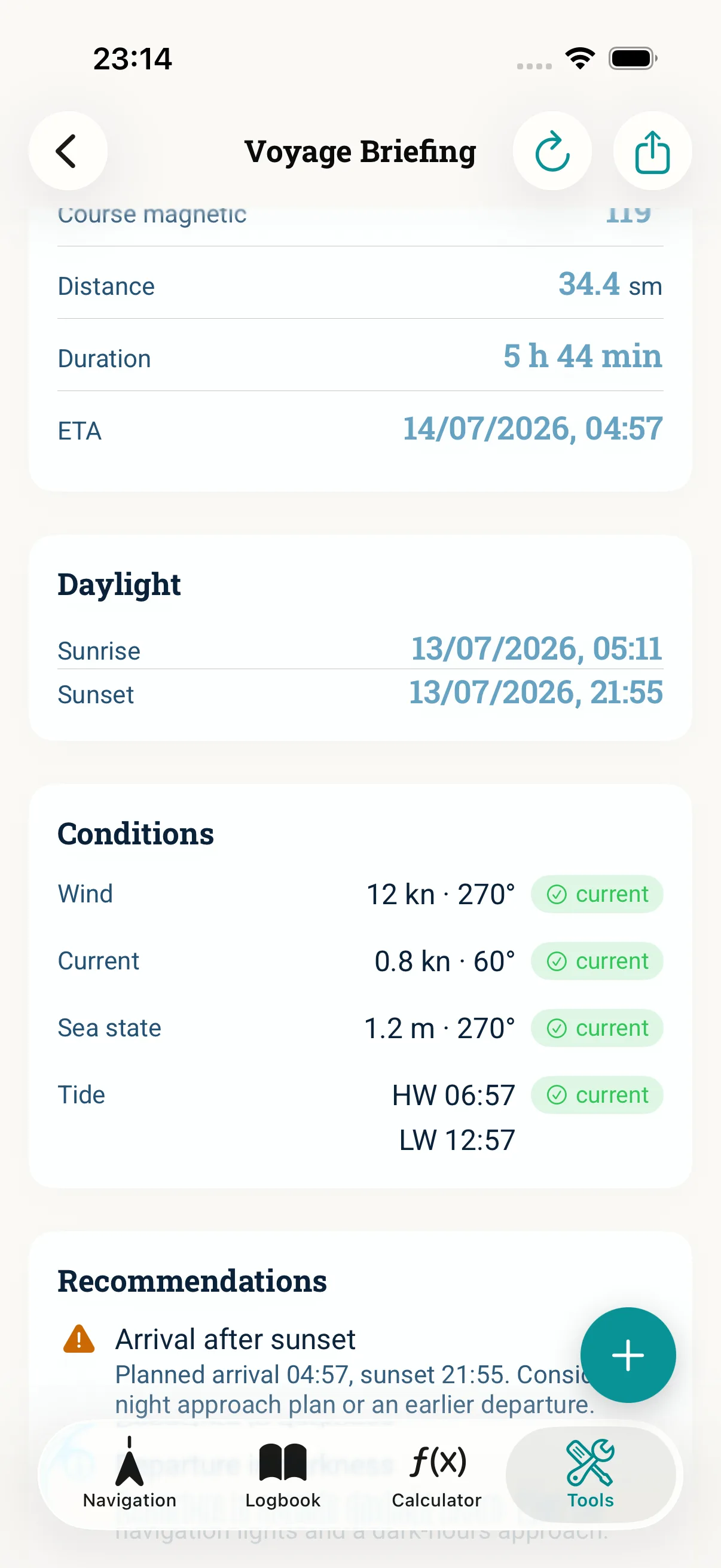
The briefing shows distance, duration and a continuous ETA chain per leg — plus weather, wind, tides, current and daylight for every section.
Step 3: Read the safety hints
Watch for hints such as arrival after sunset, departure in darkness or a reefing recommendation in strong winds. The app warns you when weather data is outdated.
Step 4: Plain language and export
Optionally the plain-language summary condenses the briefing into one readable paragraph — the AI only phrases it, it does not calculate. Your calculations stay local. Export the briefing as PDF for the crew briefing.
Common mistakes
- Expecting live weather without a weather API key — the offline core still gives course, distance, ETA, daylight and tidal windows
- Missing the warning about outdated weather data
- Treating the briefing as a replacement — it is no substitute for official charts or a weather report
Read next: Voyage Briefing (feature) · Plan ETA for the leg